
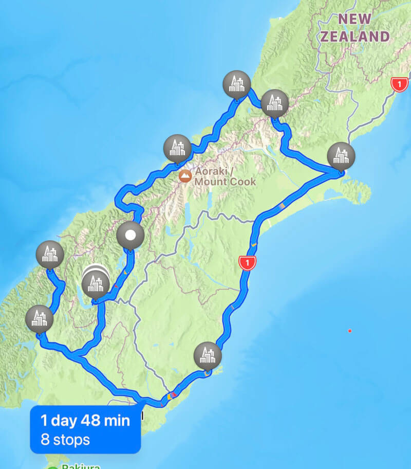
Quick Stats
Recommended time: 8-9 days
Highlights: Milford Sound, Fiordland National Park, Queenstown, Fox Glacier, Dunedin, random road discoveries
Main Highways: Highways 1, 6, 73 (Arthur’s Pass), 94 (Milford Sound)
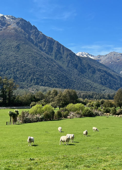
Put California’s Lake Tahoe, Switzerland, Hawaii and the UK in a blender, and you might get New Zealand. It doesn’t take much driving for snow-capped mountains to turn into Kauai-style tropical terrain…after passing by a sheep pasture. The common belief that New Zealand is full of sheep pastures is true, but they are a small slice of the scenery this island has to offer. The driving, by the way, is a clenched-tight-to-the-wheel-trying-to-stay-alive style, as it is done on the left side of the road. Thank God my good friend Jerry is along on the trip as an extra pair of eyes.
We quickly found the people of New Zealand to be incredibly friendly and welcoming, and the country embraces a relaxing pace of life that will be drawing me back again. On multiple occasions locals heard my yankee accent and quickly offered advice on what spot to hit next or where to grab the best pub grub. The congeniality here seemed to come from a different era – a time when people were trusting (you pump the gas first here – then pay!), engaged in real conversations, and not glued to smart phones.
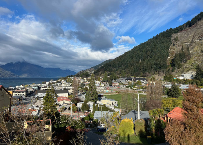
Queenstown (pop. 11,000)
Looking out the window on the flight from Auckland to Queenstown, North Island’s rolling green terrain turned to epic snow-covered ranges resembling the Swiss Alps. When the flight was about an hour from Queenstown, it looked like you could ski from the mountains straight into the ocean.
Sitting in in a bowl of snow capped mountain ranges alongside Lake Wakatipu, a pal described Queenstown as California’s “Lake Tahoe (link) on steroids.” Aside from the awe inspiring scenery, Queenstown has vacation town vibe that reminds of South Lake Tahoe, with everything geared towards the outdoors…and eating and drinking, with British-style pub options.
We filled our two days here doing four awesome activities:
Gondola and Luge Rides
We raced corner-gripping slot cars down twisting tracks at the top of a hill overlooking Queenstown and the lake. Caught air on a couple of the sudden drops!
Nevis Swing
Known as “The Most Famous Swing in the World,” it was an adrenalin rush swinging across a huge canyon. The high winds, which cancelled the nearby bungee jump, added some chaos!
KJet boat
We got soaked as this turbo-powered adrenalin boat spun 360’s and cut turns on a dime through Lake Wakatipu.
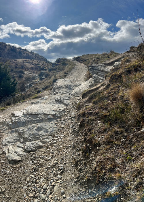
Queenstown Hill Hike
We raced corner-gripping slot cars down twisting tracks at the top of a hill overlooking Queenstown and the lake. Caught air on a couple of the sudden drops!
Both days were capped watching rugby and Australian Rules football on pub TV’s. On the first night there, the pubs were packed with Guiness-guzzling locals yelling and booing when underdog Brisbane lost to the locally-hated Collingwood Magpies in the Australian Rules Football final. The patrons explained the Magpies are the New York Yankees of the sport, and everyone wanted the top dog to go down…
Queenstown from Queenstown Hill
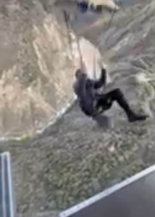
Nevis Swing
Queenstown Hill
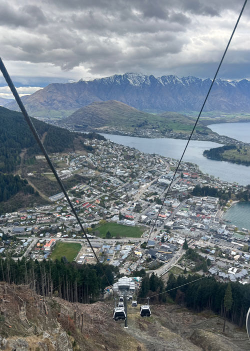
Queenstown from gondola
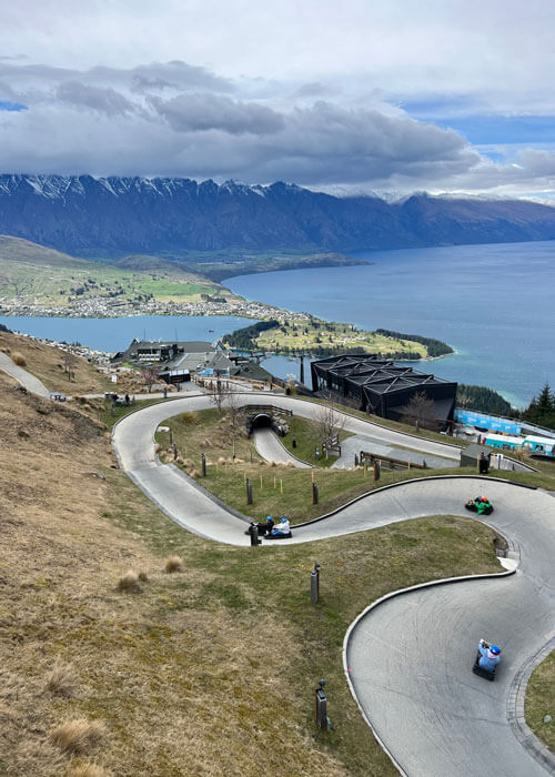
Queenstown Luge Ride
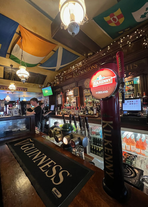
Local pub
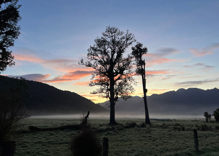
Lake Wanaka
En route to Fox Glacier, we stopped to gaze at the glass-like stillness of Lake Wanaka. Standing alone in the lake is “that wanaka tree,” a famous 80-year-old tree that has become a social media phenomenon (with the #thatwanakatree hashtag). We were joined by other tourists stopping by to get photos.
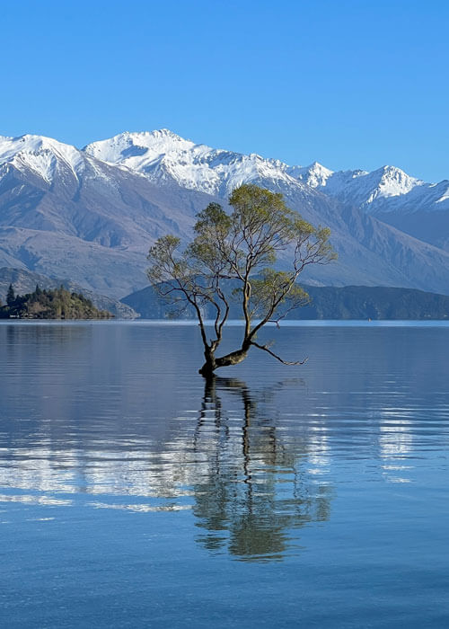
Lake Wanaka and “that wanaka tree”
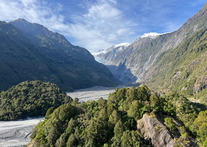
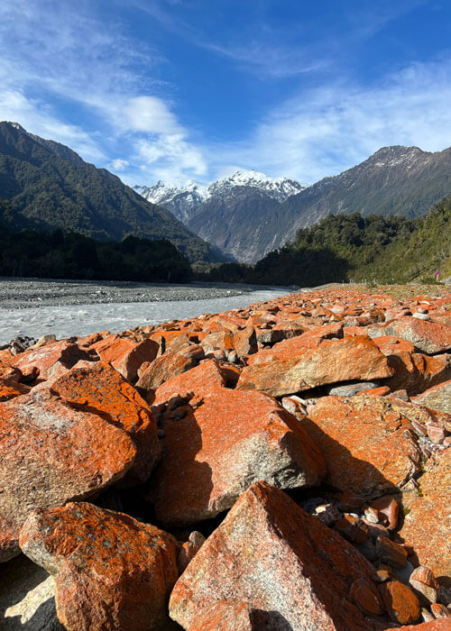
Fox Glacier (pop. 250)
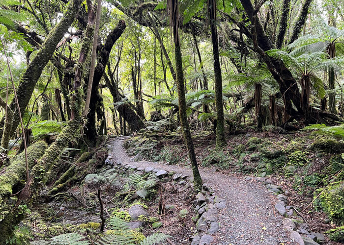
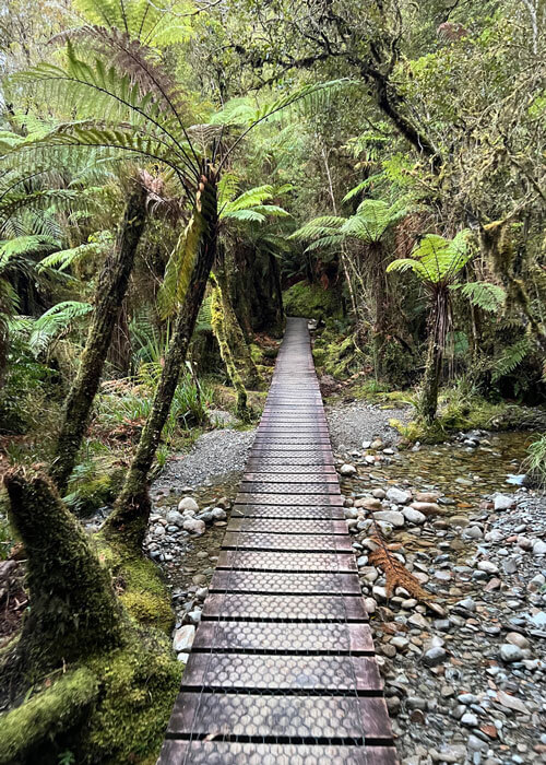
After arriving in Fox Glacier, we hiked three miles to the Fox Glacier viewpoint. While the glacier spilling into the canyon was far off in the distance, the canyon scenery was a site to behold. (Luckily, I was able to get a better pic of the glacier from a vista point in town later.) We took a detour off the main trail back to the car – a moss covered route called the Moraine Walk that looked like scenery from The Hobbit (a recurring visual theme in New Zealand).
With only 250 people, it wasn’t a surprise that the same woman who checked us in at the hotel waited on us for dinner at the local bistro. She recommended the whitebait, which are clumps of savory tiny bait fish that are only available two weeks of the year. They were delicious, and topped off with a local stout called Panhead, the meal at the Betsey Jane Eatery was one of the best of the trip.
After dark, we hit the famed Minnehaha Walk, which was right outside the door of our motel, The Bella Vista (New Zealand’s Hampton Inn). The walk is known for its glowworms, and in the pitch black of night, these mysterious worms unwittingly helped us find our way back to the trailhead.
Moraine Loop
View from Betsey Jane Eatery
Fox Glacier
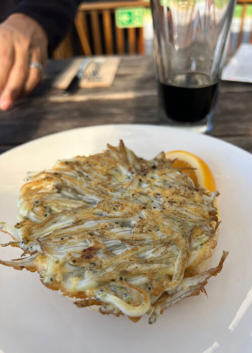
Whitebait
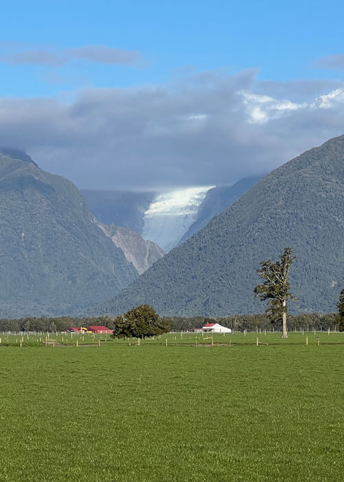
Fox Glacier (glacier visible at center)
Near Fox Glacier (algae on rocks)
Lake Matheson
The next morning we pulled ourselves out of bed early to hit nearby Lake Matheson (all the Fox Glacier locals said we had to hit this at sunrise, and we were wishing them pain as our alarms went off). Turns out they were right, and we forgave them as the loop had one incredible view after another, including the tallest mountain in New Zealand – Mount Cook.
Plank on Lake Matheson Loop
Lake Matheson Loop
Lake Matheson Loop
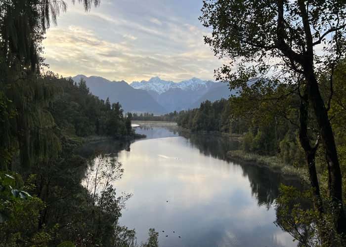
Lake Matheson (Mount Cook, snow peak at center)
Lake Matheson Loop
Arthur’s Pass
The drive from Fox Glacier to Christchurch went over a beautiful mountain pass with massive sheep pastures. The Otira Viaduct looked like some futuristic road out of the Jetsons: a narrow road on columns rises and winds high into the mountains. We stopped at a bizarre place for a soda called Otira Stagecoach Motel – which had a hobbit wizard statue in front and a giant alien on the roof. New Zealand is fortified with wacky random discoveries like this.
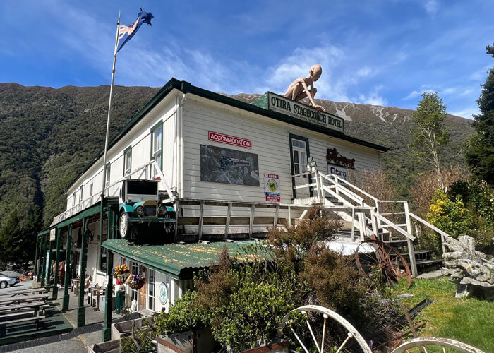
Otira Stagecoach Motel (Gollum from Lord of the Rings on roof!)
Sheep staring at me on Arthur’s Pass
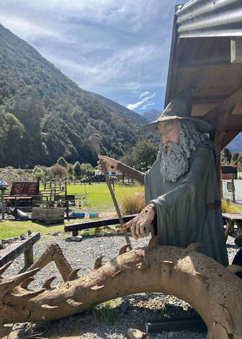
Wizard from The Hobbit at Otira Statecoach Motel
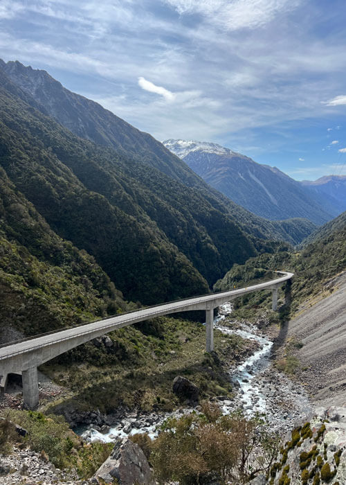
Otira Viaduct
Christchurch (pop. 400,000)
As we arrived in Christchurch, we couldn’t believe how flat it was for a city this large. No downtown buildings appeared over two stories – and most looked very minimal in design. In speaking with locals, we found this was due to the massive earthquake that hit Christchurch in 2011, leveling most of the town. The city has been rebuilding at a rapid pace.
In keeping with the aforementioned random wackiness we were discovering in New Zealand, we had pizza at a place called “Hell”. It was anything but hell, and we about rolled back to the motel after the large deluxe featuring steak. The next morning we checked out the Christchurch Botanic Garden, which had a ton of pathways to explore. Proving again that New Zealand is full of randomness, we came across this surreal “stairway to nowhere” art piece called “Diminish and Ascend”, which reminded of some Led Zeppelin album cover; it gave the illusion of a “stairway to heaven” disappearing into the sky.
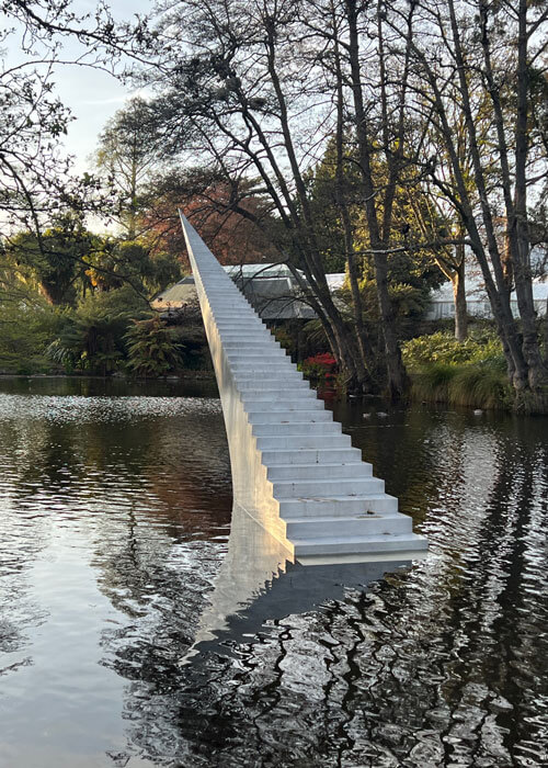
“Diminish and Ascend” art looking from Led Zeppelin album cover
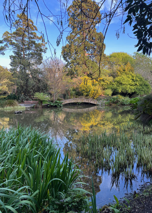
Christchurch Botanic Garden
Moeraki Boulders
En Route from Christchuch to Dunedin we came across the Moeraki Boulders, these mysterious stone balls that appeared on the beach eons ago. According to NewZealand.com: “Each boulder weighs several tonnes and is up to two metres high. Scientists explain the boulders as calcite concretions formed about 65 million years ago. According to Maori legend, the boulders are gourds washed ashore from the great voyaging canoe Araiteuru when it was wrecked upon landfall in New Zealand hundreds of years ago.” There was about thirty of these spheres on the beach, and some had split open. It was relaxing catching the ocean breeze and wandering among these massive spheres, which seemed from another planet.
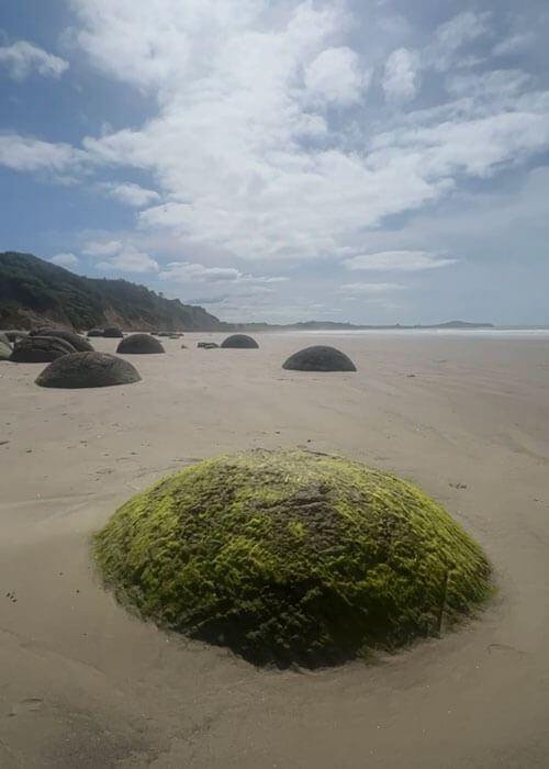
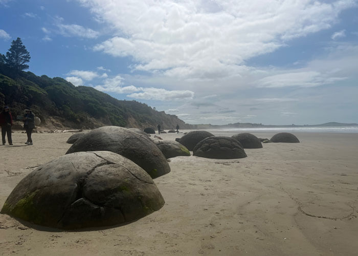
Moeraki Boulders
Dunedin (pop. 100,000)
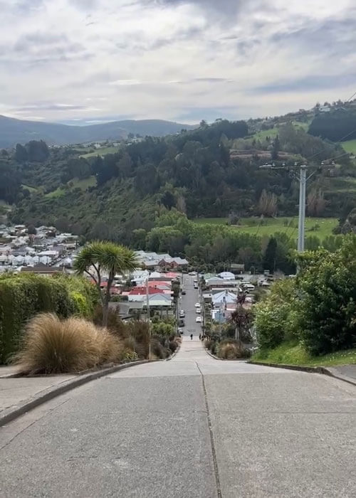
After arrival in Dunedin, we hit a spot that is in the Guiness Book of World Records: Baldwin Street. hough it lost the title to a street in South Wales UK from 2019-2020 due to a measuring controversey, it currently holds the title of the world’s steepest street. It’s max slope is a car-stalling 35 degrees (by comparison, San Francisco’s Lombard Street is 27 degrees). We tried to drive the rental car up, and it was barely crawling up the steepest pitch, engine clanking like it was about to explode. We made the decision to flip a u-turn, park at bottom, and walk up and down instead.
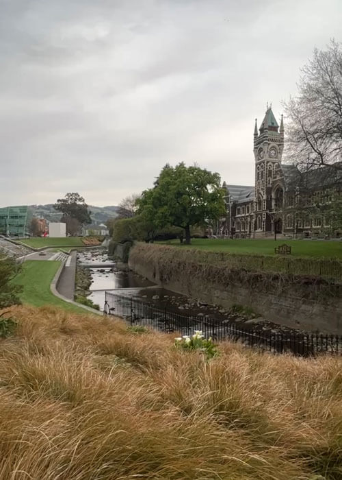
Dunedin is a college town, and the University of Otago could have been in London or Glasgow with it’s gothic revival architecture and massive clock tower. The town also had some towering Anglican churches. We discovered a Scottish pub called Anbar that served haggis – dish made from sheep’s stomach, minced onions and spices. It’s polarizing dish that some love and some hate – Michael Myers character in “So I Married an Axe Murderer” famously said he found it “repellent in every way.” I found rich and savory, and I also found it went quite well with Guiness beer.
Baldwin Street, Steepest Street in World, Dunedin
Cheese covered fried at bottom right, haggis at top, and forgot what was at left
University of Otaga, famous clock tower (1879)
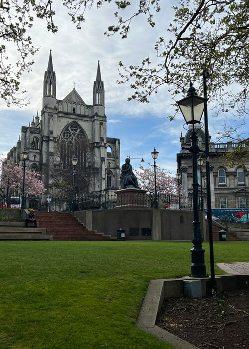
One of many gothic churches in Dunedin
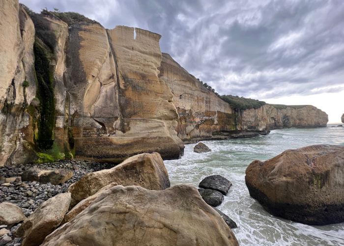
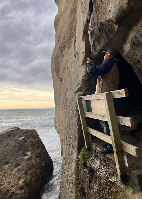
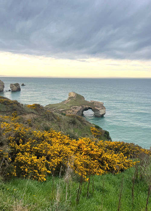
Tunnel Beach
Just south of Dunedin was a gem of a find. The Tunnel Beach trail is a steep walk down to the tops of ocean cliffs, with expansive ocean views on the way. After reaching the cliffs, we explored around and found a stairway tunnel drilled right into one of the bluffs. We ventured down the dark, damp tunnel to a spectacular beach cove and walked on top of some massive boulders, waves crashing below.
Tunnel Beach
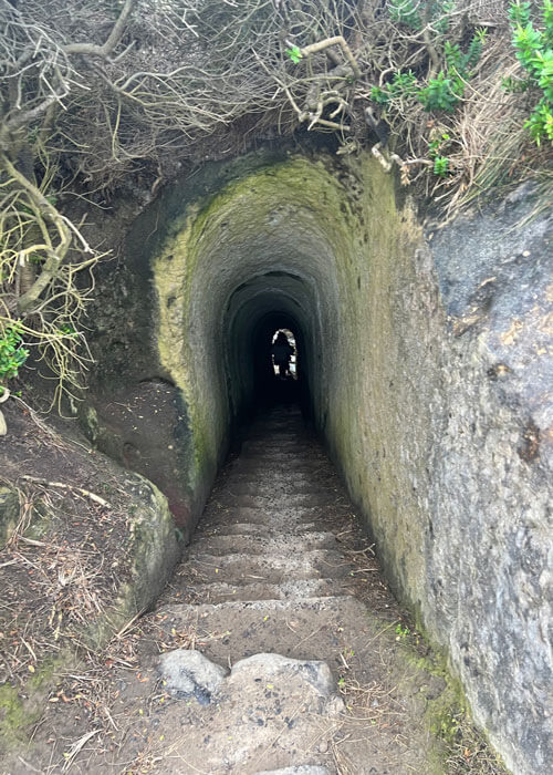
Tunnel to beach at Tunnel Beach
Tunnel Outlet at Tunnel Beach
Te Anau (pop. 3000) – Gateway to Fiordland and Milford Sound
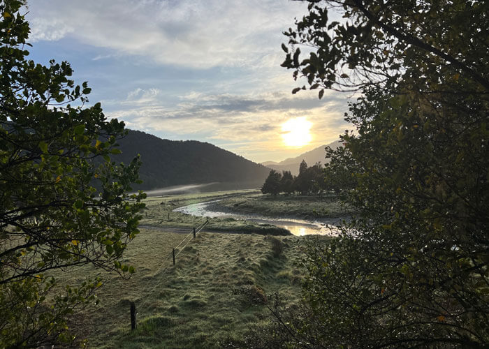
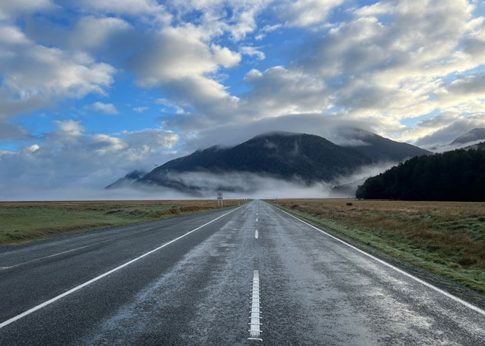
After getting a taste of the famous Kepler Hiking Track, with its lush green tropical fern terrain bordering Lake Te Anau, we headed to the trip’s grand finale: Fiordland National Park and Milford Sound. Heading down Milford Road, the scenery extravaganza began with Eglinton Valley, which was carved by glaciers thousands of years ago. It was an epic view, and we stopped to get a few road pics of the mist-covered grasslands with rocky mountains in the background.
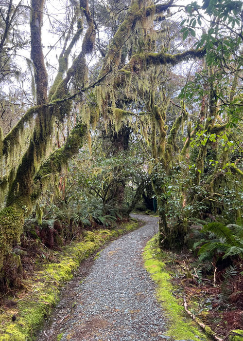
Next, we got a slice of the famous Routeburn Track. Considered one of the “Great Walks”, this hiking bucket-lister had Hobbit-like scenery with thick ferns and moss dangling tree tunnels.
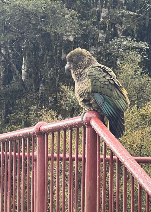
Our next stop was an overlook called Pop’s View, which looks down the massive Hollyford Valley. This was our first encounter with the famed Kea bird. A proud specimen sat on the overlook railing, unfazed by the rain or us, as if taking all the scenery in.
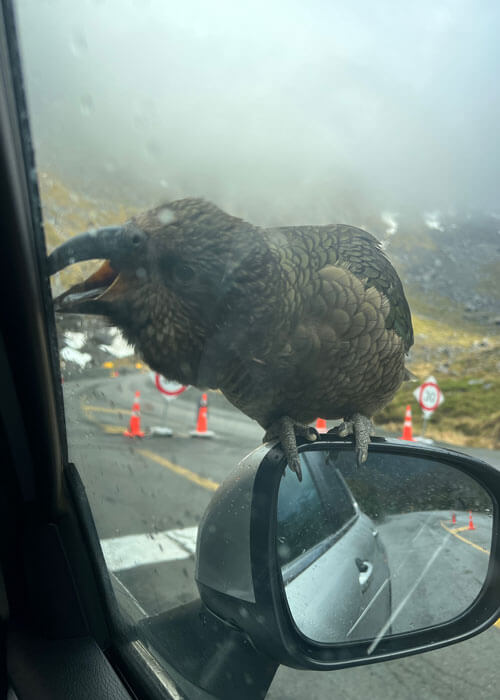
When we pulled up to a lighted stop at a tunnel, the keas got more aggressive. As we awaited the green light, three keas lept on the hood of the car – one making his way to the top of my sideview mirror. He then began gnawing at the rubber sealing on the car shoulder, trying anyway possible to get inside for a meal. Hilarious. The other Keas were marching back and forth on the hood, as if they had issued demands and were impatiently waiting for the grub. Teamwork! The comical kea bird assault finally ended when we got the green light to enter the tunnel linking Fiordland Park with Milford Sound.
As we left the tunnel, a massive valley with steep snow-dusted mountains sat in front of us, and we pulled over to get New Zealand photo number 5022 (kidding…sort of…lost count really). As the road winded down the mountain into the valley, we found ourselves pulling over for yet more photos. I need a new storage plan.
Routeburn Track
Kea bird
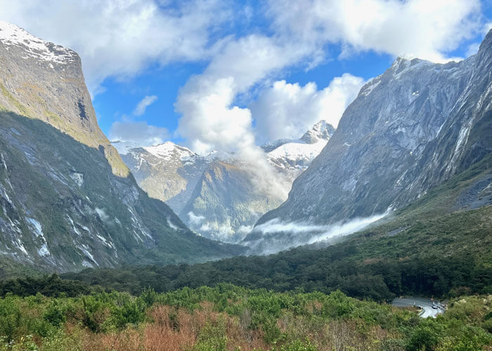
Fiordland National Park
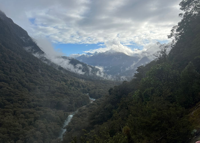
Hollyford Valley
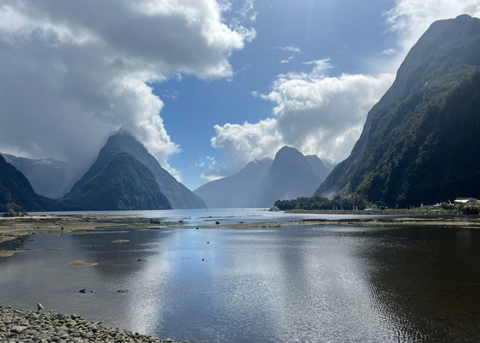
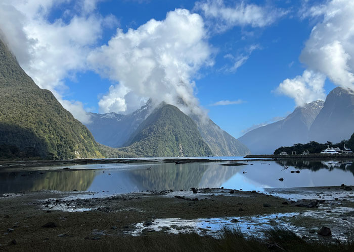
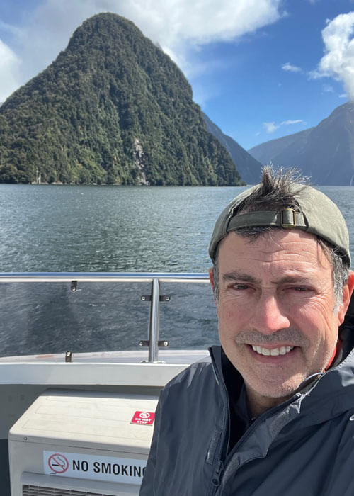
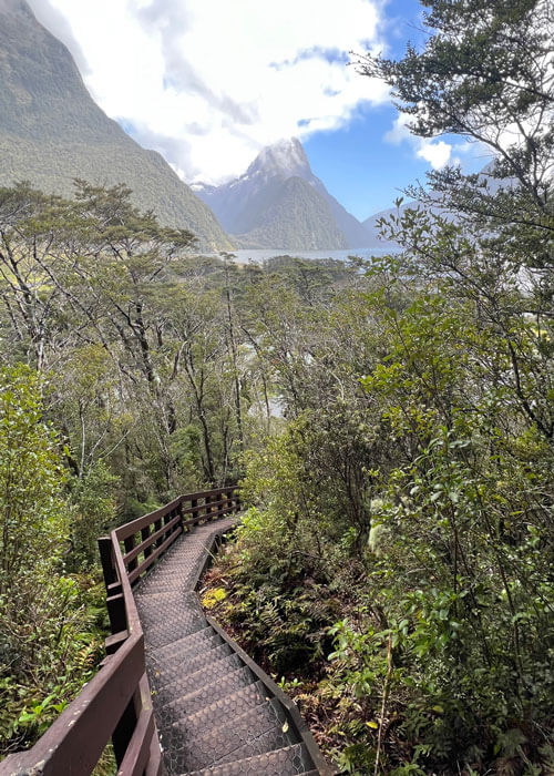
Milford Sound
As we made our way deeper into the valley, water came into view. It was Milford Sound. The anticipation built as we got closer to what has bee called the ‘eighth wonder of world.” We wandered the edge of the water, and then hopped on a two hour boat cruise.
The boat slowly weaved its way through dramatic cliff scenery, making its way to the Tasman Sea. The majesty of the surrounding peaks could not be captured in photos…if ever there was a moment where you had to be there, this was it. The surrounding rock cliffs, with multiple waterfalls in every view, had me wondering if it was all computer generated. The boat pulled underneath each waterfall, and by the end of the cruise, we were soaked.
It was the perfect finale. I recall before leaving for New Zealand a friend said “God created the world, and then he created New Zealand.” Amen.
Milford Sound
Milford Sound from shore
Milford Sound
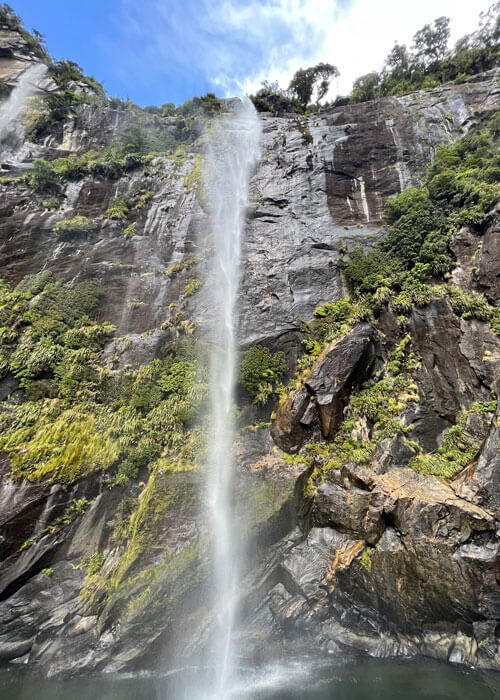
Milford Sound – One of many waterfalls
Random Notes:
- Aside from driving on left side, and about every control is on opposite side. Many times I meant to hit the turn signal – and on come the windshield wipers. This must have provided great laughs for the locals.
- They also walk on left. This created some near collisions.
- Single Lane Bridges are everywhere; a sign says who has right of way.
- Cleanest public toilets I have seen anywhere.
- A “long black” is an Americano.
- Ketchup is called “tomato sauce.” Thought that order of fries might come with some fancy tomato sauce, and it was…ketchup.
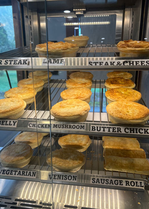
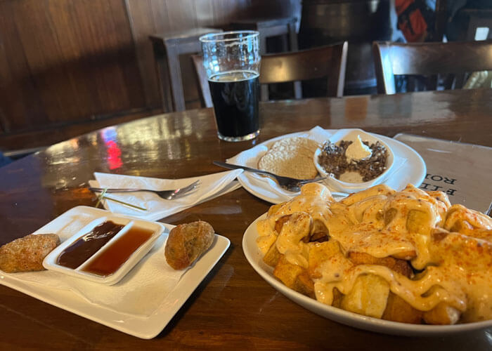
New Zealand Breakfast Options
0 Comments