

Quick Stats
Distance: 1200 miles
Recommended time: 7-8 days
Highlights: Root and Nizina Glaciers, Wrangell-Saint Elias National Park, Kenai River, Wolverine Peak
Main Highways: AK Highways 1, 3, 4
Anchorage
Bordered by the beautiful Chugach Mountains and the Cook Inlet, Anchorage is the largest city in Alaska (pop. 300,000) . I stayed at the Marriott, which is one of the tallest buildings in Anchorage and what you would expect in a Marriott – clean, efficient and recommendable.
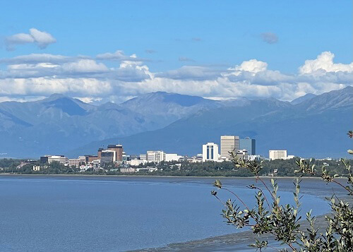
View of Anchorage from Kincaid Park
After checking in, I decided to check out Earthquake Park along the water near the airport. The path was paved, well-maintained and wove in and out of cottonwood trees with views of the water and stops like the earthquake monument. It was worth a couple hours to explore and get exercise.
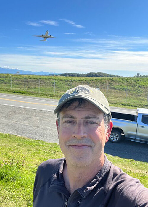
Popular selfie spot outside Anchorage International Airport near Earthquake Park
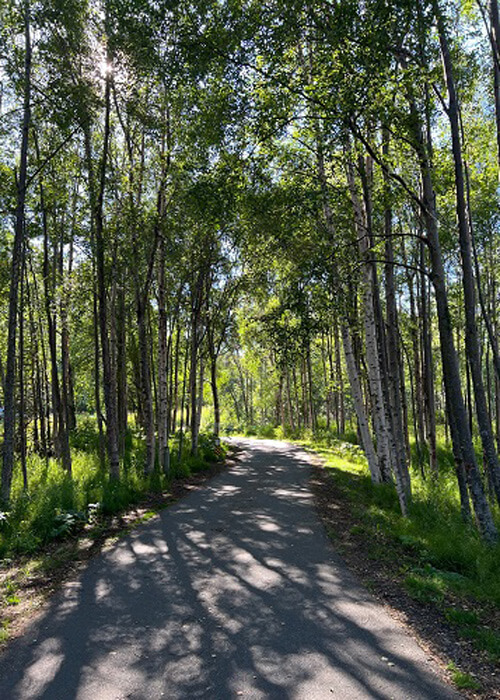
Coastal Path near Earthquake Park
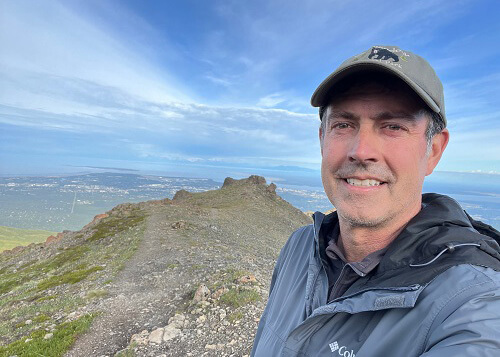
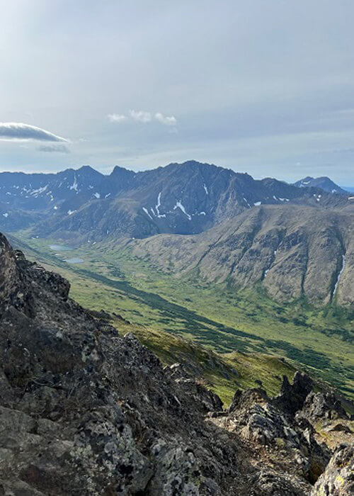
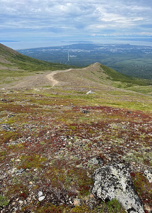
Convinced after the first afternoon that Anchorage was not going to sustain me for the next day, I logged into the trusty AllTrails app and found a gem of a hike about 20 minutes out of town called Wolverine Peak. It’s nine miles round trip, and gets steep in the final stretch, but the views at the top are epic. The end of the trail overlooks a huge valley and a string jagged rock peaks, and was very photo worthy! It’s about 4-5 hours round trip (definitely bring water and plenty of snacks).
Part way down Wolverine Peak
Near the top of Wolverine Peak
Part way up Wolverine Peak
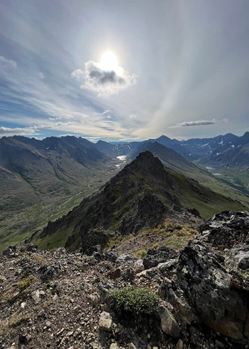
View from the top of Wolverine Peak
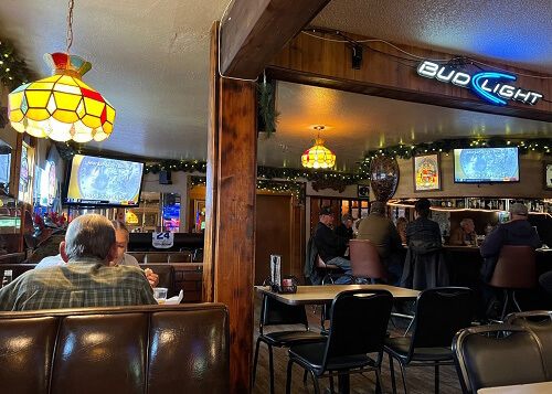
For dinner I hit a well-known Anchorage spot called the Moose’s Tooth. This is what I envisioned in an Alaskan taphouse – a woodsy inside with some excellent Alaskan brews on tap (including their own brand). The thin crust pizza had many ingenious topping combos to choose from.
After dinner I road-tripped around the outer Anchorage area and explored some of the neighborhoods in the surrounding hills, in addition to picking up some bug spray (they get ya here in August!) at this popular Alaskan chain market I recommend called Three Bears (basically a Costco and Cabela wrapped in one).
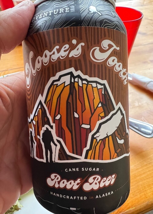
Best root beer I ever had
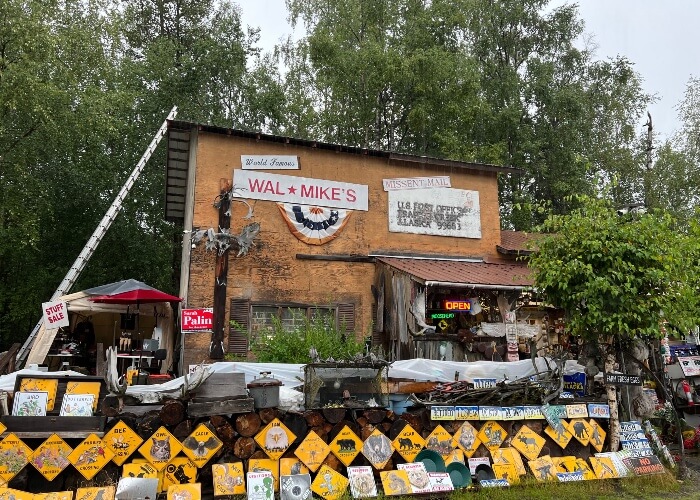
Wal Mikes, a curio shop north of Anchorage
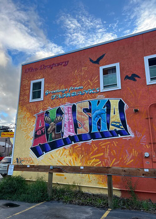
Fairbanks
I got into Fairbanks (pop. 30,000) mid-afternoon and explored the town after picking up some hiking supplies at REI. I stayed at Springhill Suites, which had a great downtown location (and self parking). Fairbanks has an old mining town sort of feel, and a scenic walk along the river that includes Golden Heart Plaza, which greets you with an entry arch of moose antlers.
Downtown Fairbanks
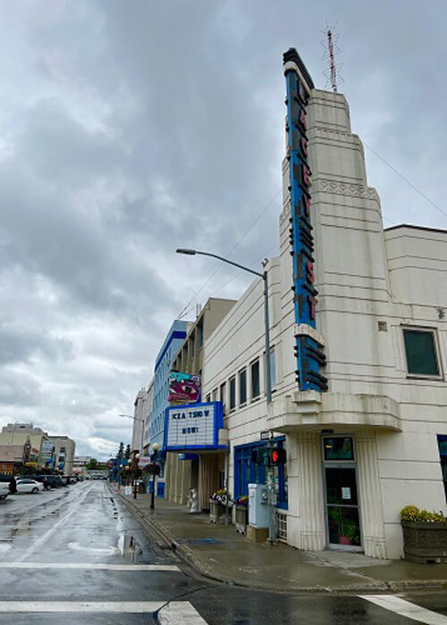
Downtown Fairbanks and historic Lacey Theatre (1940)
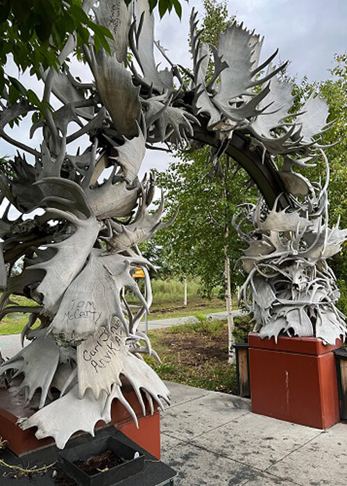
Antler Arch, Fairbanks
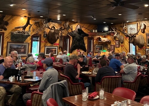
Sitting by itself about eight miles north of town is a classic Alaskan style restaurant called the Turtle Club. “There can’t possibly be a restaurant out here” I was saying to myself as I followed google maps, and then this huge parking lot comes out of nowhere. The place feels out of the seventies with its Formica table decor and beer mirror wall art, not to mention Foreigner and Peter Frampton on the jukebox! The clientele was mainly local old timers, some of which looked like they hadn’t left their barstool since then. They had excellent prime rib, which included a trip to a Sizzler-style salad bar.
Inside Turtle Club, north of Fairbanks
North Pole
After dinner I drove east about 10 miles and came to the town of…North Pole! Candy canes hang from the streetlights, and it’s got a Santa Claus house (mainly gifts and souvenirs) and a giant Santa statue near the parking lot.
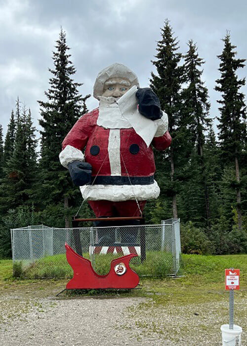
North Pole (pop. 3000) near Fairbanks
McCarthy/Kennicott
Driving to McCarthy was a fun journey; the last 60 miles was mostly unpaved backroad with a few bridge crossings and some river scenery among the endless Spruce and Cottonwood trees. A parking lot was waiting at end of road, and I crossed a footbridge over the Kennicott River and walked a mile down a dirt road to get into McCarthy.
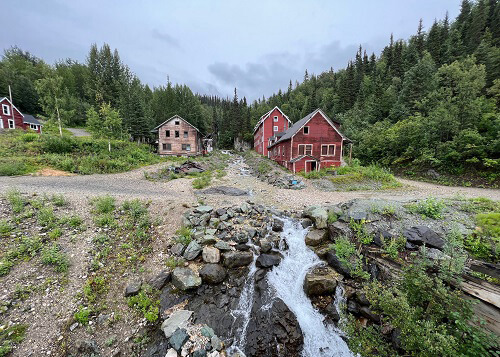
Grounds of Kennicott Processing Mill
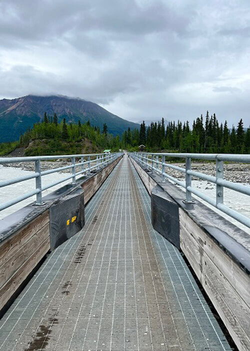
Kennicott footbridge to McCarthy/Kennicott
Kennicott River
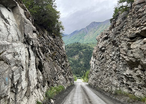
Beginning of McCarthy Road
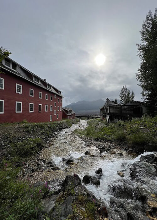
Kennicott and McCarthy are old copper mining towns that sprang up in the early 1900’s. Since Kennicott was dry, McCarthy sprang up four miles down to provide the booze and brothels to the mine workers. The Kennicott mine was active from 1911 to 1938, and much of the processing mine is still intact (and has guided tours). Still the tallest wooden structure in North America, it’s a fascinating relic to explore.
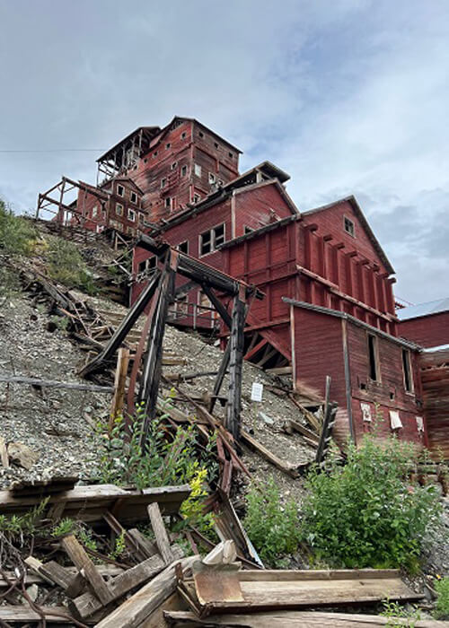
Kennicott Mine, active 1911-1938
Near Kennicott Mine
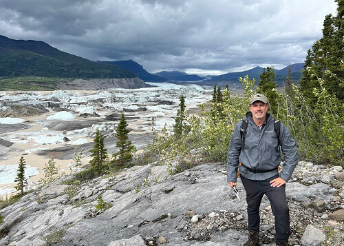
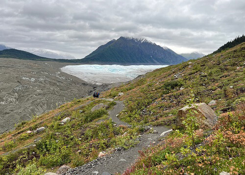
As much as I dig old mining towns, that wasn’t the purpose of driving to this remote region on a beat-up road. McCarthy and Kennicott happen to sit on the edge of the largest national park in the US: Wrangell-Saint Elias National Park. There are three things offered here I’d been wanting to do for a while: 1) Explore glaciers 2) Ice climb 3) fly in a bush plane to a remote all-day hike in the Alaskan wilderness.
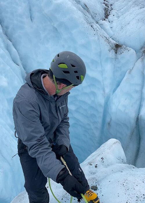
I contacted Kennicott Wilderness Guides, and they took care of everything (including the bush plane flight) and provided a very knowledgeable guide (Avery). I strongly recommend them, and Avery was very knowledgeable and helpful (particularly on navigating the glacier areas and explaining how to ice climb!).
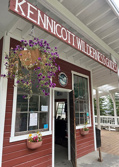
Kennicott Wilderness Guides
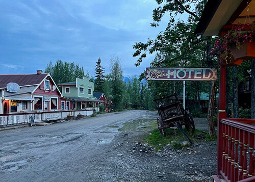
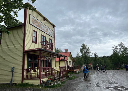
In McCarthy I stayed at the bare-bones old-west-style Ma Johnson’s Hotel (shared bathrooms and no room keys). I ate at the The Potato (delicious pulled pork sandwich) and The Golden Saloon (chicken sandwich). Aside from that, there’s a general store and museum with old mining artifacts and photos, and that’s about it…
View from Ma Johnson’s, McCarthy
Ma Johnson’s
Wandering the streets of McCarthy
Wrangell – St. Elias National Park
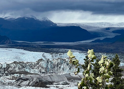
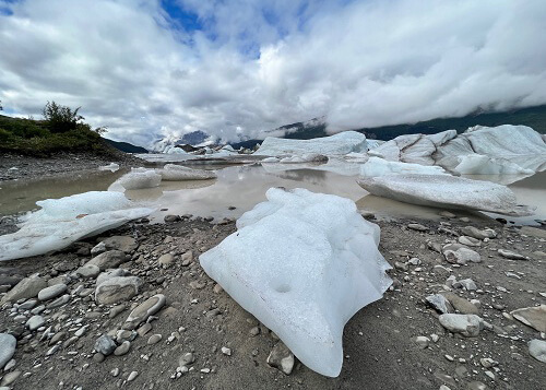
Nizina Lake and Glacier
The wilderness hike on day one started with bush plane flight over a few mountain ridges and over Nizina Lake, which was filled with random shaped and colored ice blocks from the Nizina Glacier. Overhead it looked like a candy selection from a See’s box.
We spent the day hiking on “moraines” (ridges of glacier sediment), through beautiful wide open dryas fields and over various rock shelves overlooking the lake and glacier. The only trails here were made by bears, and it was liberating to be totally detached from any formal trail system and not see a soul for the entire day. This was 100% unadulterated wilderness, and it was awesome..,
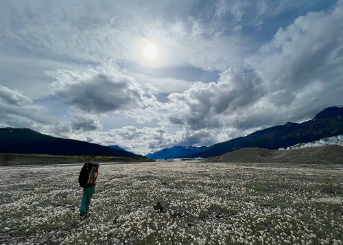
Dryas field near Nizina Glacier, Doubtful Creek area
Ice Waterfall view from Root Glacier
Nizina Lake and Glacier
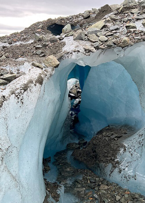
Ice hole (center right) on Nizina Glacier
One of the highlights of the day was just kicking it in front the glacier wall perched in front of us like a theater, and watching nature unfold: One minute a loud “kerplunk” from an ice break and the next a low thunderous growl from the glacier “calving” (forming a split). There was rarely complete silence, and the glacier sounded like a living, breathing beast…
Watching the Nizina glacier in action
Edge of Nizina Lake
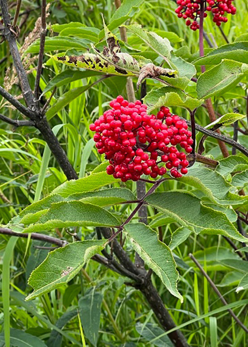
Bears can eat 200,000 of these soapberries a day
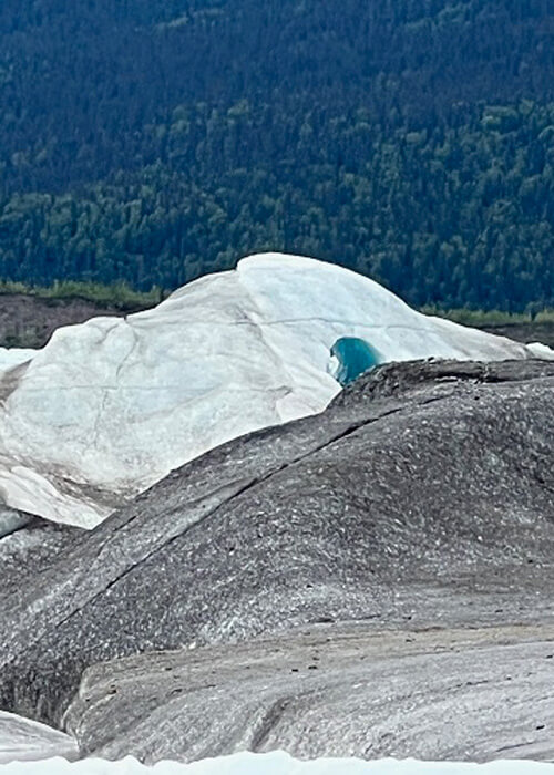
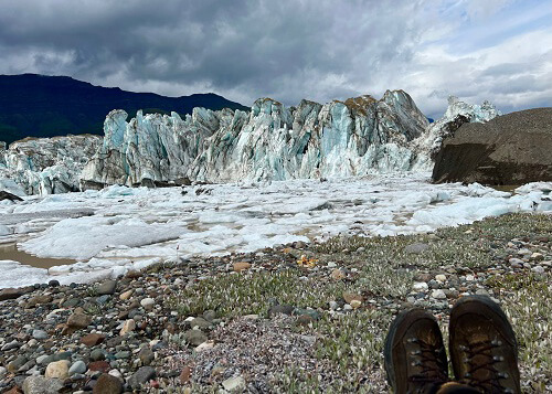
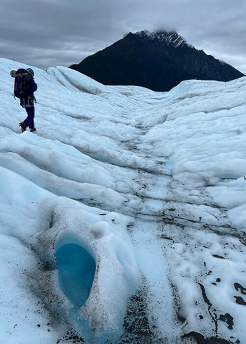
Root Glacier
On day two we hiked from Kennicott to the Root Glacier on a two-mile trail overlooking a huge valley. This access trail was a beautiful warm-up before getting on the glacier. We stopped just before what looked like a dirt mound to put on the hiking boots and crampons, and I thought for sure the guide was confused and we had stopped too early to put on the teeth. After stepping on the “dirt” I realized why: the teeth made a loud crunch sound as the crampons slid through the dirt layer and gripped the ice.
It’s a surreal and relaxing experience walking among the massive formations of white and blue, not knowing what’s over each ridge. Narrow rivers flow through indents, and twist, turn and spiral down into blue pools or disappear down moulins (long, narrow holes that seemingly go forever). I couldn’t help but think of this as being some grand design of a water amusement park! This was a hike that will never be forgotten.
Approaching Root Glacier
Root Glacier
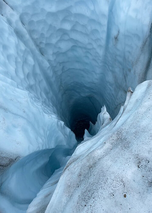
Moulin
Moulin
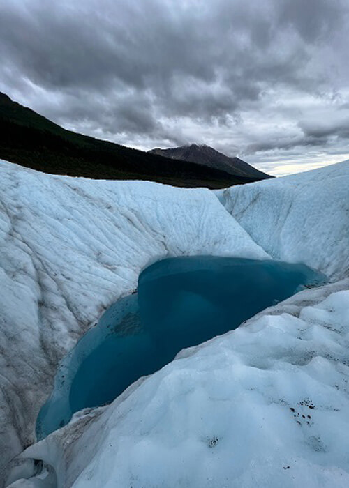
Blue pool
Ice tunnel
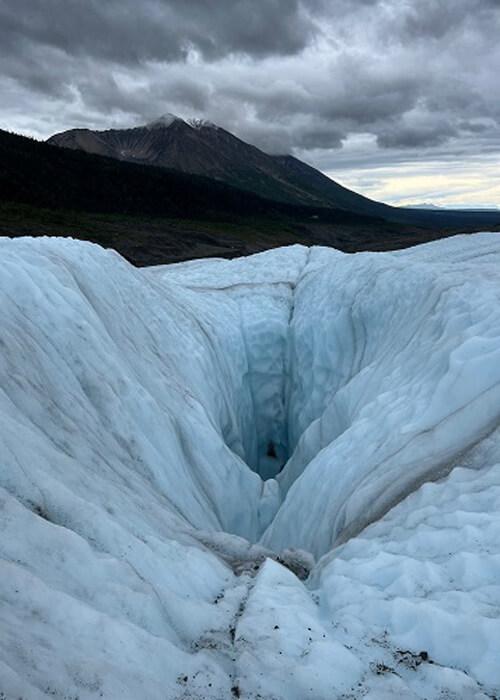
A highlight of the glacier hike was the ice climb lesson, which involved scaling a wall and then rappelling back down. The front teeth poking out of the crampons stick to the ice like glue! The guide also set up a special rappel session later in the day that allowed us to lean over a steep, narrow moulin to view the water deep below and get photos.
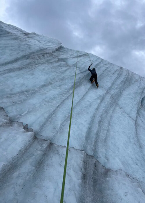
Ice climbing for the first time
Peering down a moulin
Soldotna
The drive from McCarthy to Soldotna was about nine hours, and covered in rain, so not much to tell here. I got into town early evening, and decided to hit Louie’s Steak and Seafood in Kenai after reading all the good Yelp reviews. It had a very Alaskan vibe with animal heads all over the walls, and had excellent prime rib and sides.
Louie’s Steak & Seafood in Kenai
The mission in Soldotna was simple: catch fish. I stayed at the Angler’s Inn, which had good rates and clean rooms.
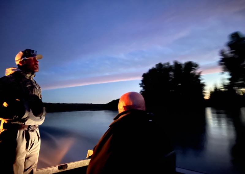
Heading to fishing spot on Kenai River at 4:30am
I found FishingForFun guided fishing tours online. We met at 4am on Kenai River, and after cruising the river for about twenty minutes in the dark, we parked the boat at an “in the know” location right before sunrise. We then put on the waders and cast our reels. Sunrise on the Kenai gave the clouds an awesome orange glow, and I had to take a fishing break and bolt back to the boat and grab my camera for some pics!
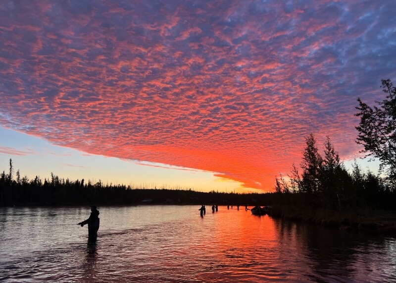
Fishing for sockeye salmon at sunrise
We fished the entire morning about 20 yards from the river bank, and our three-person group caught the 18-sockeye-salmon-limit just as our session ended at noon. Our guide at FishingForFun was James Walker, and I recommend his guidance!
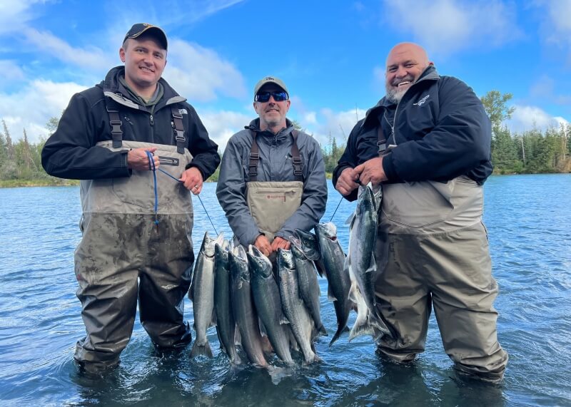
Our haul on Kenai River
Since the afternoon was free, I decided to pull out the map and head south to Homer (known as the “Halibut Fishing Capital of the World”) to scout out Homer as a possible fishing base for next summer’s trip to Alaska.
Homer
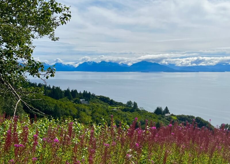
The 70-mile drive from Soldotna to Homer was filled with spruce trees and bright purple dwarf fireweed lighting up the edges of highway. As Homer got closer, Kachemak Bay came into view.
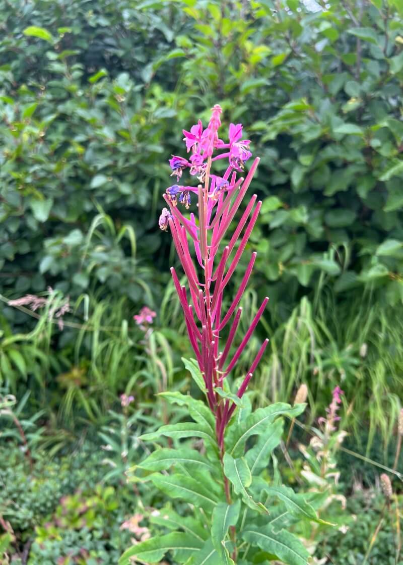
Dwarf fireweed, which borders the highway between Soldotna and Homer
Just as I entered Homer I came across a vista point overlooking Kachemak Bay and the snow-covered mountains in the distance. Continuing down tHighway 1 leads to a peninsula (called Homer Spit) that turns into a Fisherman’s Wharf-like collection of shops and restaurants. One “genuine” notable locale here is the Salty Dog Saloon, a lighthouse styled saloon built in 1897 that has been featured on Discovery Channel series “Deadliest Catch.”
View from Homer Lookout Point
I then drove around Homer for a bit more, taking in the beautiful views of the bay and mountains, and discovering some potential fishing lodges for a halibut trip next year.
As it turns out, this trip has ended where next year’s might begin…
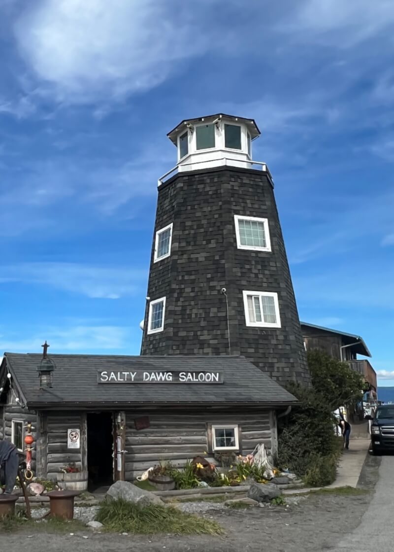
Salty Dawg Saloon, Homer
Summary:
If I had to pick three highlights of this trip, they would be:
- Root Glacier
- Nizina fly-in hike
- Fishing Kenai River
- Honorable mention: Wolverine Peak
The wide-open, majestic expanses of the state are breathtaking, and it is one heck of a road trip state. Ironically, it was what Alaska didn’t offer for extended stretches that was another highlight of the trip: cellular service. This “missing” connection with today’s information overload world only makes me want to head back sooner…
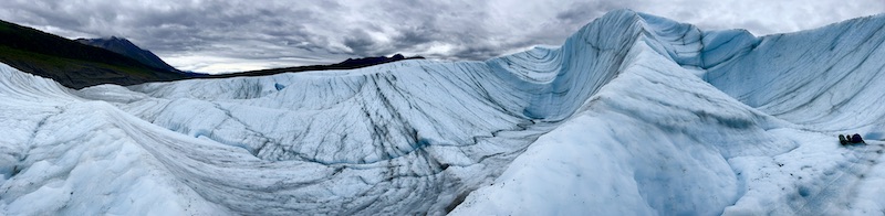
Root Glacier
0 Comments