
Quick Stats
Distance: 1000 miles
Recommended time: 4-7 days
States: California (CA), Arizona (AZ), New Mexico (NM)
Highlights: Grand Canyon, Route 66, Hermosa Beach, Meteor Crater, White Ridge bike trails, film locations and awesome random discoveries
Main Highways: I-40, I-15, Route 66, AZ-64
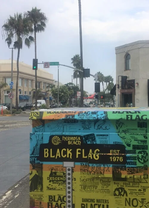
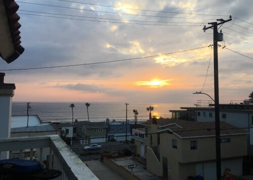
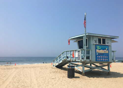
Hermosa Beach
Los Angeles’ Hermosa Beach is a lively beach community sitting in between Manhattan and Redondo Beach. The beaches are beautiful and clean, and the pier plaza and surrounding areas have a ton of restaurants, bars and shops. You could spend all day biking up and down the beach strand to Santa Monica and see about every flavor under the sun. It has an edgy surfer vibe, and was also one of the epicenters of LA’s punk rock scene of the 70’s: Black Flag, The Descendents and The Circle Jerks are from here.
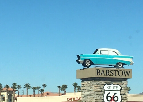
Barstow
In the Mojave Desert about three hours east of LA is Barstow. You may have heard the town’s name in the famous “get your kicks on Route 66” song, as Barstow was major stop on the iconic highway. Originally founded as a silver mining town in the 1880’s, it became a major rail hub before becoming a freeway hub for the I-15 and I-40. A dusty “oasis in the desert,” scenes from Kill Bill Vol. 2 and From Dusk Till Dawn were filmed here. It’s worth a drive through town on the Route 66 portion to check out some of the retro motels and nostalgia.
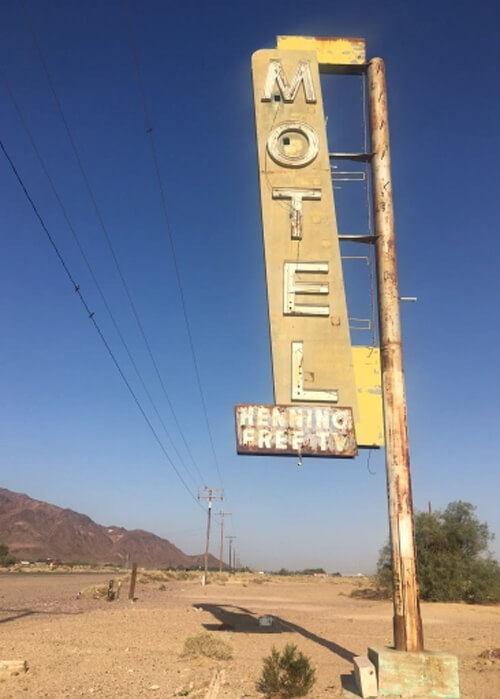
Newberry Springs
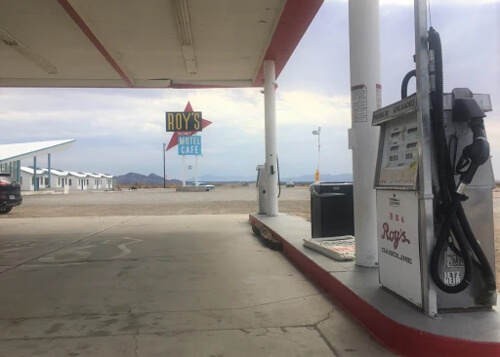
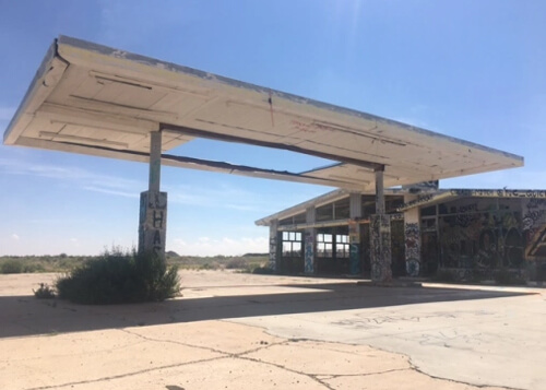
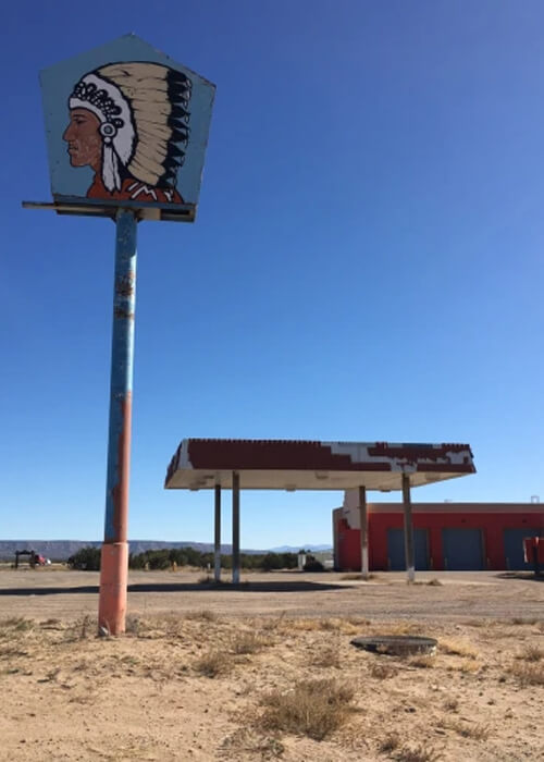
Heading east out of Barstow on I-40, some vintage Route 66 sign relics start appearing in the Newberry Springs area. At Ludlow, I recommend taking the Route 66 detour to Amboy for more road relics, including the famous Roy’s Motel and Cafe. Movies filmed here include Kalifornia and The Hitcher, and Rush drummer Neil Peart (RIP) stayed at Roy’s in his road odyssey book Ghost Rider.
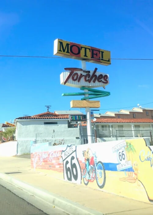
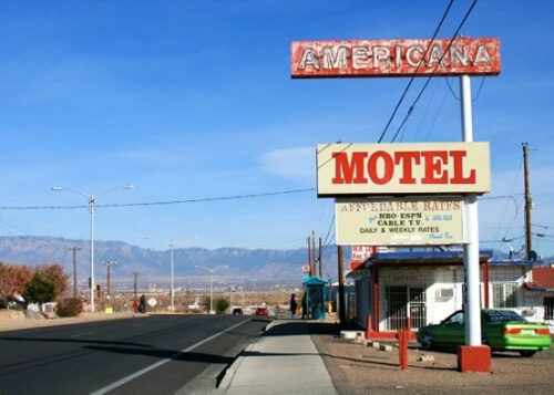
Needles
A stop for the Joad family in The Grapes of Wrath, Needles is the last stop in California. Similar to Barstow, the town pays homage to Route 66, and has some cool retro motels and murals saluting the Mother Road. Temperatures here can reach well into the 120’s in the summer.
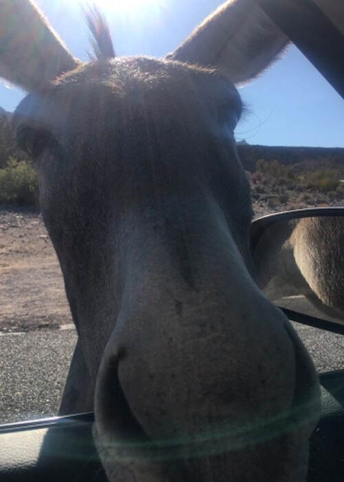
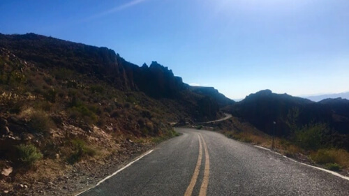
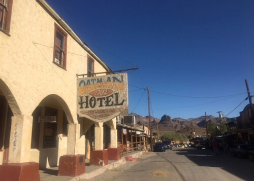
Oatman
The old west gold mining town of Oatman AZ was almost abandoned when the highway connecting Kingman and Needles was built in 1953. It caters to Route 66 tourists now, with a ton of tourist shops, and is known for it’s wild (but tame) burros, one of which poked it’s head in my car window for grub. The drive is slow and winding drive through the Black Mountains, and had some epic vistas. The end of this stretch landed me in Kingman, where scenes from the cult classic Two Lane Blacktop were filmed.
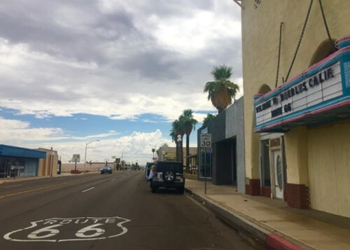
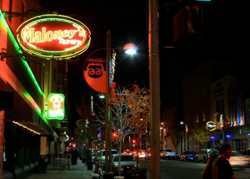
Hackberry, Seligman and Williams
On the way to Seligman I revisited the dusty desert stop of Hackberry, which I stopped by back in 2000 and mentioned in this article I wrote for DesertUSA.
After visiting Seligman, which has more Route 66 curios, ice cream stands and candy stores (sign me up!), I arrived at Williams after sundown. This town puts on a good show at night – the main drag was lit up neon, and is alive with music and activity. I stopped at the Cruiser’s Cafe for some classic greasy spoon from yesteryear – no organic in this joint!
Grand Canyon
Not going to waste your time here explaining the awe of the Grand Canyon, but it was as spectacular and stunning as it is hyped to be, and one of those lifetime bucket list trips that you simply have to do. There are a ton of vista point stops along the South Rim for photos.
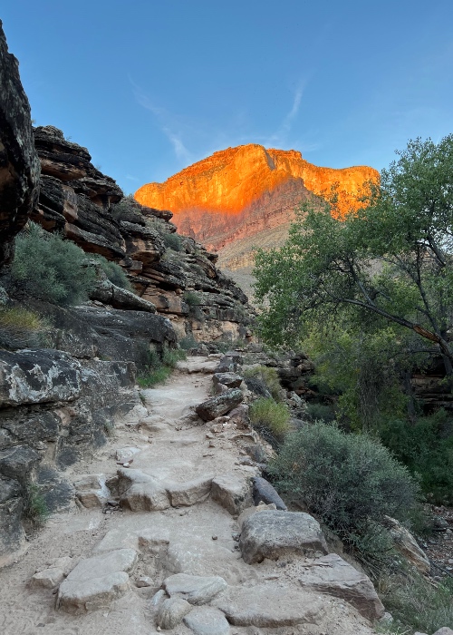
I hiked the Bright Angel Trail, which goes to the bottom (Colorado River) and back out. To make sure I beat the daytime heat, I started at 5am with a headlamp, and made it to the Colorado River in about three hours. That was the easy part. Then the fun begins. The hike back out of canyon took about four hours, and those last two miles are a punishing crawl.
There are numerous lodges in the South Rim of the park, but they book up months in advance. I stayed at the El Tovar, and recommend it because the canyon is literally outside the front door, and is a short walk from the Bright Angel and South Rim hiking trails. It’s a rustic, woodsy lodge with animal heads on the walls but with all the modern amenities. Outside the park, Tusayan, Williams and Flagstaff are also options for lodging.
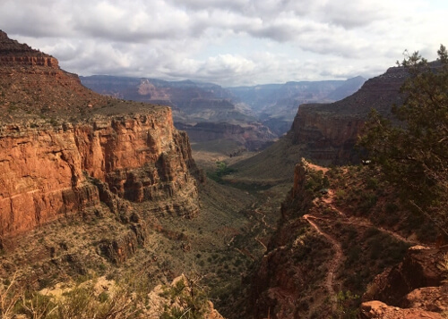
South Rim, Grand Canyon
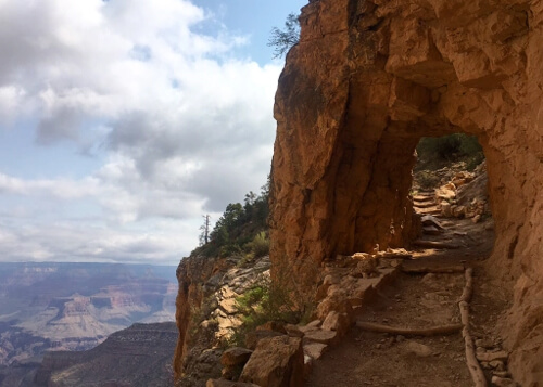
Bright Angel Trail
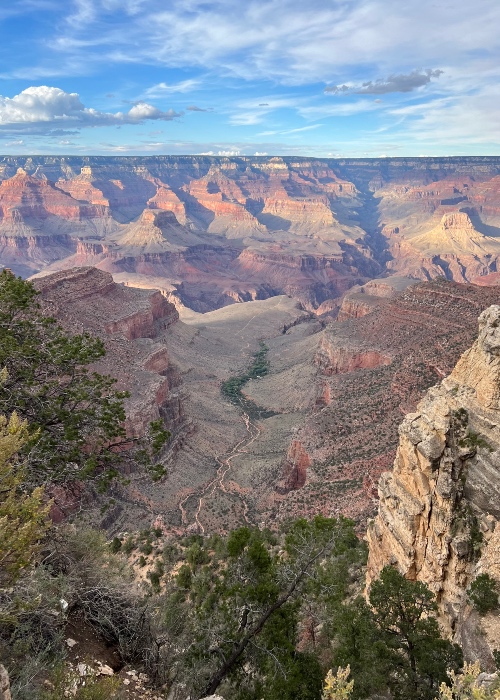
View from South Rim
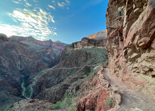
Bright Angel Trail
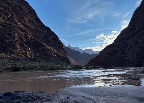
Colorado River
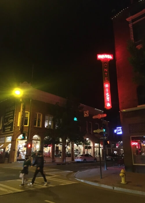
Flagstaff
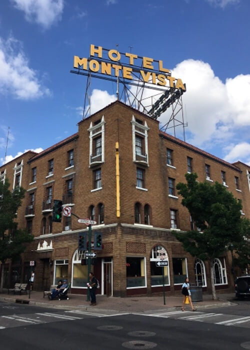
Flagstaff is about 90 minutes from the south gate of the Grand Canyon, and a fun town to explore on foot. I stayed at the allegedly haunted Hotel Monte Vista, which has a lively bar downstairs that I could hear from my 3rd floor room (or were they drunk ghosts?). Coming through my window was a rock cover band playing Hendrix and Cream outside on a sidewalk.
While in Flagstaff, I had a delicious Navajo Taco at Salsa Brava at Salsa Brava (which was on Diners, Drive-Ins and Dives) and saw Saturn and Jupiter up close at the Lowell Observatory. You’ve seen these planets on TV and in the text books, but seeing it live through one of their monster telescopes is an experience to behold!
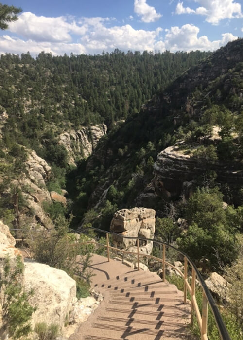
Walnut Canyon
Walnut Canyon was a nice surprise about a half hour east of Flagstaff. Overshadowed by the nearby Grand Canyon, Walnut Canyon gets no love, but is worth a stop for a couple hours to do the short hikes and check out the rock geology and cliff dwellings. The hike has some great views and goes partway down the canyon.
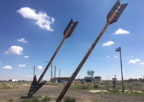
Route 66 from Walnut Canyon to Meteor Crater
Between Walnut Canyon and the next stop, Meteor Crater, is some more vintage road art. The Twin Arrows Trading Post Ruins are a classic Route 66 relic, and featured in the movie Forest Gump. The defunct town of Toonerville at this location has a history of murder and suicide, and the area is supposedly haunted…
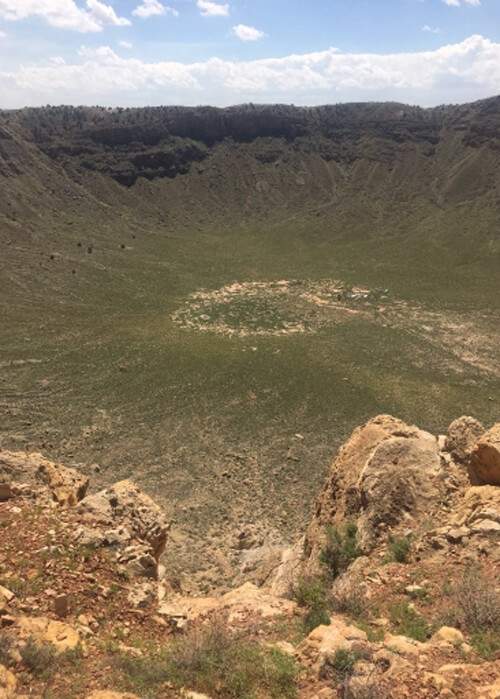
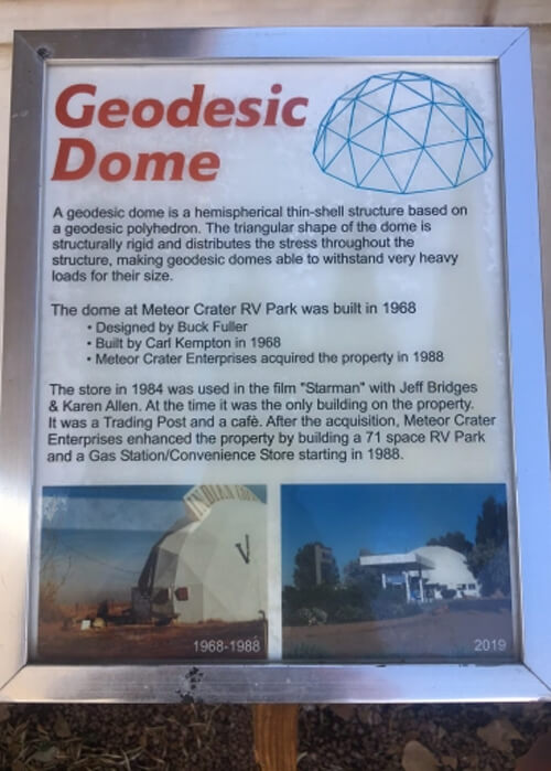
Meteor Crater
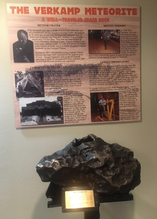
About 40 miles east of Flagstaff is what I thought would be one of those sounds-boring-but-what-the-heck stops you come across on road trips. Of course, some of these end up being the hidden gems, and Meteor Crater was one of them. Once you reach the ledge to get your first peak of the crater, the sheer size and perfect bowl shape is jaw dropping. As the visitor center points out, this is the best preserved meteorite crater in North America.
The attached museum (admission fee required for crater and museum) gives a fascinating history of meteor which crashed some 50,000 years ago, and the landowners quest to find the meteorite (a telescope on the edge shows where he dug for years, reaching 200 feet deep). A slab of this meteorite is at Flagstaff’s Lowell Observatory (photo in the Flagstaff section above). It’s about twice the size of a football and weighs 535 pounds (92% iron). There is also an Imax-like 4D meteor flight viewing experience, complete with shaking seats, air blowing in your face and asteroid fragments hitting your legs.
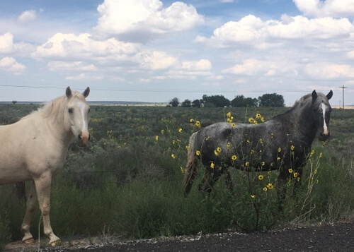
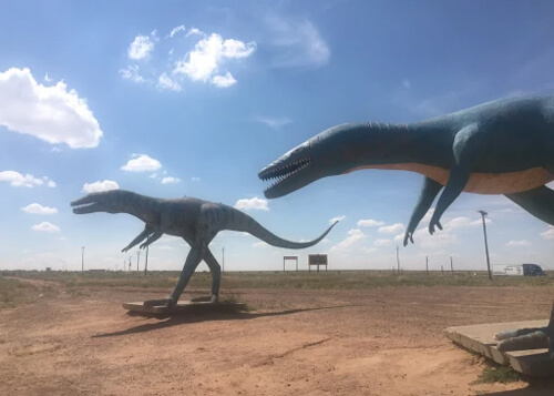
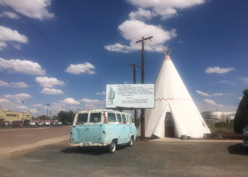
Holbrook
Approaching Holbrook, I got off I-40 onto a frontage road and came across wild horses and concrete dinosaurs. Holbrook has the Route 66 Clark Griswold landmark Wigwam Motel, which is on the National Register of Historic Places. You can still book a tepee for the night here.
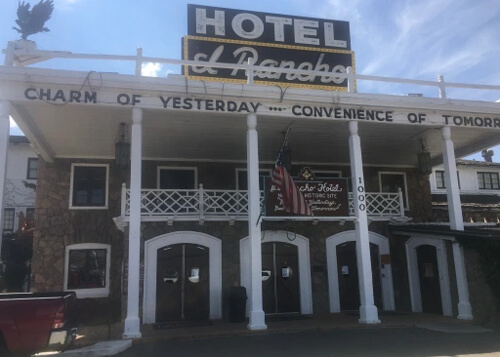
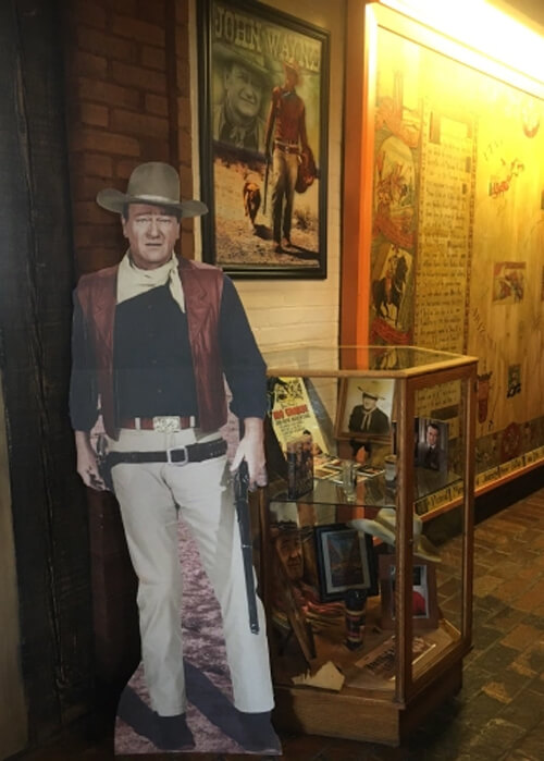
Gallup
Gallup is a dusty town howling with train horns (founded as a railhead for Atlantic and Pacific Railroads) and lined with Native American shops selling rugs, jewelry and random stuff. I dropped by the famous El Rancho Hotel, which has walls of photos of movie icons like John Wayne that stayed here. The surrounding area was popular filming location for westerns in the 1940s and 1950s.
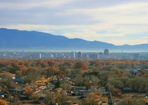
Albuquerque
Route 66 continues into the most populous city of New Mexico, Albuquerque (pop. 600,000). Being a major city there’s a lot to explore here, but I only had a couple hours and checked out a couple film locations from a series I watched, Breaking Bad. One unique thing about Albuquerque is its architecture code requiring major sections of the city to follow a simple adobe pueblo style. I tried some New Mexican cuisine at Sadie’s, which I recommend if you like spicy (for the uninitiated, New Mexican is a blend of Mexican, Tex Mex and Native American cuisine…the key ingredient being New Mexican red and green chiles).
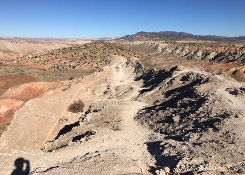
White Ridge Trails
To wrap the trip up, I decided to rent a mountain bike and head 45 minutes north of Albuquerque to the White Ridge trail network in San Ysidro. Biking there felt like biking on the moon. Beautiful yet barren white landscape with some geothermal features, unlike anything I had ridden in California.
Youtube Video of Trip
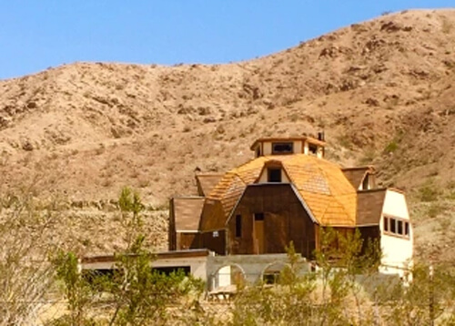
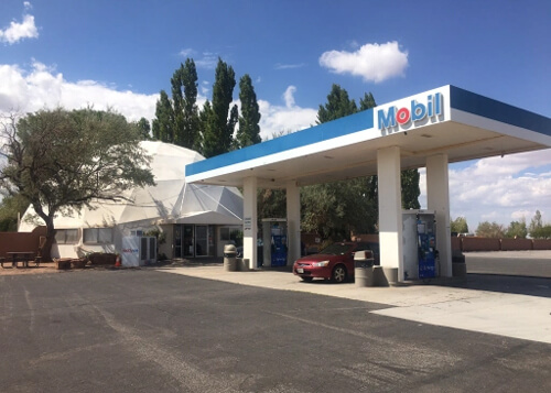
Geodesic Structures
I kept spotting these “half-dome” structures throughout the trip. After discovering one of these housing an Exxon food mart, I had to find out what these structures are about.
They are creation of Walther Bauersfield, a German engineer who first designed one as a planetarium to house a projector after World War I. But it was Buckminster Fuller, a sort of futurist/inventor/architect/Elon Musk-type visionary, that got the US patent and put these on the map by designing the US Pavilion Dome at the 1967 World’s Fair in Montreal (now the Montreal Biosphere). Called geodesic domes, there are supposedly incredibly strong, energy efficient, and resilient to weather. I’ve noticed them mainly in isolated desert locations, and unfortunately some are in crumbling states of decay.
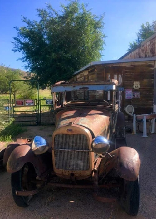
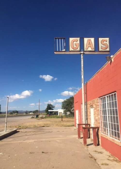
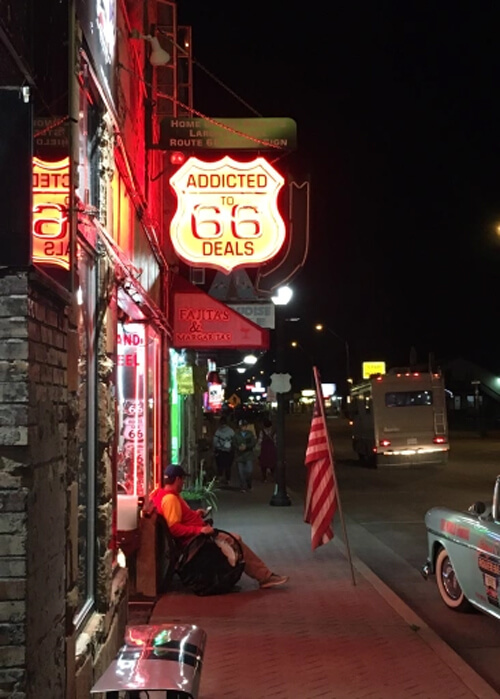
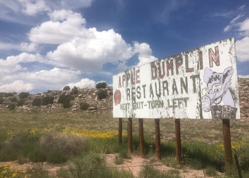
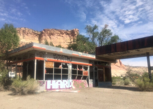
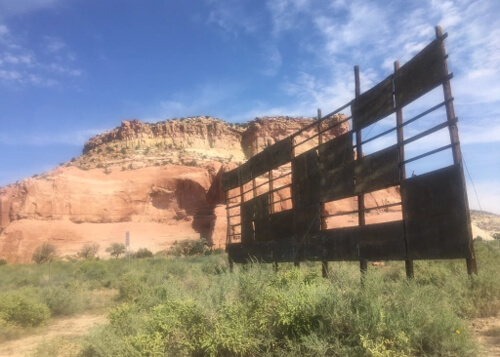
Extra photos off Route 66
0 Comments